Introduction
Mappls is a strong example of an India-focused mapping and location-intelligence platform. It combines digital maps, navigation, location search, traffic information, route planning, and location-based services.
For startups and businesses, building an app inspired by Mappls can be an opportunity to create a specialized GPS navigation, mapping, location intelligence, or route-planning platform for a specific market.
The cost to build an app like Mappls can range from approximately $50,000 to $300,000+, depending on whether you are building a navigation-focused MVP or a complete mapping ecosystem with proprietary data, real-time traffic, APIs, fleet management, advanced routing, and enterprise solutions.
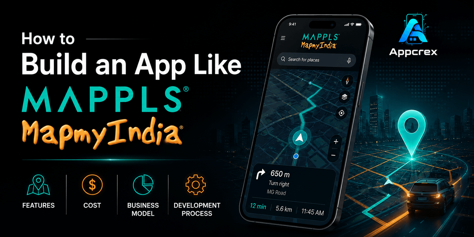
This guide explains how to build an app like Mappls, including features, development cost, business model, technology stack, APIs, GPS functionality, development process, timeline, and monetization opportunities.
What Is an App Like Mappls?
A Mappls-like application can combine digital mapping with navigation and location intelligence.
A platform may provide:
- Interactive maps
- GPS navigation
- Turn-by-turn directions
- Location search
- Route planning
- Traffic information
- Nearby places
- Real-time location sharing
- Geocoding
- Reverse geocoding
- Fleet tracking
- Location APIs
- Distance calculations
- Route optimization
- Enterprise mapping services
The important thing is that you do not need to replicate an entire national mapping ecosystem to launch a successful product.
A startup could instead focus on a specific use case such as:
- GPS navigation app
- Logistics route-planning platform
- Fleet tracking solution
- Delivery navigation app
- Travel navigation application
- Emergency response mapping
- Real-estate location intelligence
- Business location platform
How Much Does It Cost to Build an App Like Mappls?
The development cost depends on the scope of the mapping platform.
| App Type | Estimated Cost |
|---|---|
| Basic GPS Navigation MVP | $50,000–$80,000 |
| Advanced Navigation App | $80,000–$150,000 |
| Location Intelligence Platform | $150,000–$250,000 |
| Full Mapping Ecosystem | $250,000–$300,000+ |
These are software development estimates. Costs for proprietary mapping data, satellite imagery, map licensing, traffic data, cloud infrastructure, APIs, and other third-party services can add substantially to the total investment.
Just Read : Car Rental App Development Company Dubai: Complete Guide to Features, Cost & Development Process
Why Is a Mappls-Like App Expensive?
A simple location app can be relatively inexpensive.
A large-scale navigation platform is very different.
It may require:
- Mapping data
- GPS processing
- Routing engines
- Traffic information
- Search infrastructure
- Geospatial databases
- Map rendering
- Location APIs
- Real-time data processing
- Cloud infrastructure
- Mobile SDKs
If you want to build your own mapping data rather than use an existing provider, the investment becomes significantly larger.
Key Features of an App Like Mappls
1. Interactive Digital Maps
The map is the foundation of the application.
Users should be able to:
- Zoom
- Pan
- Search locations
- Change map views
- Select locations
- View roads
- View landmarks
- Explore nearby places
The map should remain responsive even when displaying large amounts of geographical data.
GPS navigation is one of the most important features.
The application can provide:
- Current location
- Destination
- Route
- Distance
- Estimated travel time
- Turn-by-turn directions
- Voice navigation
The navigation engine continuously compares the user’s location with the planned route.
Instead of simply showing a line between two locations, the system can provide instructions such as:
- Turn left
- Turn right
- Continue straight
- Take the next exit
- Make a U-turn
The system needs to calculate the user’s position and determine when the next instruction should be triggered.
Voice guidance allows users to navigate without continuously looking at the screen.
Possible functionality includes:
- Spoken directions
- Distance announcements
- Route-change notifications
- Traffic alerts
- Arrival notification
Voice navigation can support multiple languages depending on the target market.
5. Location Search
Users should be able to search for:
- Restaurants
- Hotels
- Hospitals
- Petrol stations
- Charging stations
- Airports
- Shopping centers
- Businesses
- Landmarks
A powerful location-search system can become one of the most valuable parts of a mapping platform.
6. Nearby Places
The application can identify locations around the user.
For example:
Restaurants within 2 km
or:
EV charging stations near my current location
The system uses geographic coordinates and search radius calculations to retrieve relevant locations.
7. Geocoding
Geocoding converts an address into geographic coordinates.
For example:
Address → Latitude + Longitude
This is useful for:
- Delivery
- Navigation
- Logistics
- Real estate
- Travel
- Location search
8. Reverse Geocoding
Reverse geocoding performs the opposite operation.
Latitude + Longitude → Address
This can be used to determine the approximate address associated with a user’s current GPS coordinates.
9. Route Planning
Users can select:
Starting Point → Destination → Route
The system calculates the best available route based on factors such as:
- Distance
- Travel time
- Road network
- Traffic
- Restrictions
- Route preferences
10. Multiple Route Options
Instead of providing only one route, the application can show several options.
For example:
- Fastest route
- Shortest route
- Alternative route
- Toll-free route
This gives users greater control over navigation.
11. Real-Time Traffic
Traffic data can improve route recommendations.
The system may consider:
- Congestion
- Road closures
- Accidents
- Construction
- Slow-moving traffic
Real-time traffic functionality requires reliable traffic data sources and continuous processing.
Also Read : Mobile App Development Consulting Company: Turn Your App Idea into a Successful Mobile App
12. Rerouting
If the user moves away from the planned route or traffic conditions change, the system can calculate an alternative route.
Typical flow:
GPS Location → Route Comparison → Traffic Analysis → New Route → Navigation Update
Fast rerouting is particularly important for driving and delivery applications.
13. Offline Maps
Offline navigation allows users to access selected map data without continuous internet connectivity.
Possible functionality:
- Download map area
- Store map tiles
- Offline search
- Offline routing
- Offline navigation
Offline functionality increases development complexity because map data needs to be stored, updated, and managed efficiently.
14. Live Location Sharing
Users can share their current location with others.
Potential use cases include:
- Family
- Friends
- Delivery
- Field teams
- Fleet operations
- Emergency services
Users may choose how long their location remains available.
15. Location History
A location platform can allow users or authorized businesses to review historical routes.
Possible information includes:
- Previous locations
- Routes
- Distance traveled
- Travel duration
- Stops
Because location data can be sensitive, strong privacy controls are important.
16. Saved Places
Users can save frequently visited locations.
Examples:
- Home
- Work
- Favorite restaurants
- Customer locations
- Warehouses
This makes repeat navigation faster.
17. Business Listings
A mapping platform can provide business profiles containing:
- Business name
- Address
- Phone number
- Opening hours
- Website
- Photos
- Reviews
- Location
Businesses can potentially claim or manage their listings through a dedicated portal.
18. Fleet Management Integration
One of the strongest commercial opportunities around mapping technology is fleet management.
Businesses can monitor:
- Vehicles
- Drivers
- Routes
- Locations
- Distance
- Fuel-related information
- Delivery progress
This creates opportunities beyond consumer navigation.
Also Read : Fleet Management Software Development: Complete Guide to Features, Cost & Development Process
19. Delivery Route Optimization
For logistics businesses, the platform can calculate optimized routes for multiple deliveries.
For example:
Warehouse → Customer A → Customer B → Customer C → Customer D
The optimization engine can attempt to reduce:
- Total distance
- Travel time
- Fuel consumption
- Number of unnecessary stops
This feature can become a separate commercial product.
20. EV Charging Station Finder
A modern navigation platform can integrate EV charging locations.
Users can search for:
- Charging stations
- Charger types
- Available connectors
- Charging networks
- Nearby stations
This can be especially useful for EV-focused navigation applications.
Also Read : EV Charging App Development Company in Dubai: Complete Guide to Features, Cost & Development Process
21. Public Transport Information
Depending on available data, a mapping platform can include:
- Bus routes
- Metro stations
- Train stations
- Transit stops
- Arrival information
Public transit functionality requires appropriate transit data sources.
22. Emergency & Safety Features
A specialized navigation platform can include:
- Emergency locations
- Hospitals
- Police stations
- Fire stations
- Safety alerts
- Road hazard reporting
This can create a differentiated use case for certain markets.
Admin Dashboard
A mapping platform requires an extensive administrative system.
Administrators may manage:
- Users
- Businesses
- Places
- Map data
- Reports
- Location data
- API usage
- Subscriptions
- Traffic information
- Notifications
The dashboard can also provide analytics.
Map Data Management
One of the most technically important aspects is managing geographical data.
A mapping system can involve:
- Roads
- Buildings
- Boundaries
- Points of interest
- Coordinates
- Addresses
- Traffic information
Geospatial databases are often used to store and query this information efficiently.
APIs for a Mappls-Like Platform
A commercial mapping platform can expose APIs to other businesses.
Potential APIs include:
Maps API
Display maps inside third-party applications.
Geocoding API
Convert addresses into coordinates.
Reverse Geocoding API
Convert coordinates into addresses.
Routing API
Calculate routes between locations.
Distance Matrix API
Calculate travel distances and times between multiple locations.
Places API
Search for businesses and points of interest.
Provide navigation capabilities to other applications.
API monetization can become an important B2B revenue source.
Also Read : What Is API Integration? A Complete Guide to Benefits, Types & Best Practices (2026)
Technology Stack for a Mappls-Like App
Mobile Development
Possible technologies include:
- Flutter
- React Native
- Swift
- Kotlin
For navigation-heavy applications, native platform functionality may be important depending on the complexity of GPS, background location, and device integration.
Backend
Common choices include:
- Python
- Node.js
- Java
- Go
The backend should be designed to handle large amounts of location requests.
Geospatial Database
A geospatial database is important for mapping applications.
Possible technologies include:
- PostgreSQL + PostGIS
- MongoDB
- Redis
- Elasticsearch/OpenSearch
PostGIS can be particularly useful for geographic queries.
Mapping Technology Options
You don’t necessarily need to create a mapping engine from scratch.
Depending on your requirements, you can integrate mapping technologies and data providers.
Possible approaches include:
Third-Party Mapping APIs
Fastest way to launch an MVP.
Open Mapping Data
Can provide greater customization but requires additional infrastructure and data management.
Proprietary Mapping Data
Provides maximum control but can dramatically increase the cost and operational complexity.
GPS Technology
GPS functionality depends on smartphone location services.
The application can collect:
- Latitude
- Longitude
- Speed
- Direction
- Accuracy
The system can combine GPS information with mapping and routing services to provide navigation.
AI Features for a Mappls-Like App
AI can make location applications more intelligent.
AI Route Prediction
The system can learn from historical traffic and travel patterns.
Natural-Language Search
Users could ask:
“Find a family-friendly restaurant near me.”
The AI can convert the request into a structured location query.
Intelligent Route Recommendations
AI can analyze:
- Traffic
- Time
- User preferences
- Historical routes
to recommend suitable routes.
Predictive ETA
Machine-learning models can improve estimated arrival times by analyzing historical and real-time data.
Development Process
Step 1: Define Your Target Market
Decide whether the product is designed for:
- Consumers
- Logistics
- Fleet operators
- Travel businesses
- Delivery companies
- Enterprises
- Government organizations
Step 2: Choose the Mapping Strategy
Determine whether you will use:
- Third-party mapping APIs
- Open mapping data
- Your own mapping data
This decision has a major impact on cost.
Step 3: Define the MVP
A basic navigation MVP could include:
- User registration
- Interactive map
- GPS location
- Search
- Routing
- Turn-by-turn navigation
- Voice directions
- Saved locations
- Basic admin panel
Also Read : What Is an MVP in App Development? A Complete Guide
Step 4: UI/UX Design
Design the major screens:
- Home/map
- Search
- Navigation
- Route selection
- Place details
- Saved locations
- Profile
The map should remain the primary visual focus.
Step 5: Backend Development
Develop:
- User management
- Location APIs
- Search
- Routing
- Places
- Push Notifications
- Analytics
Step 6: GPS & Map Integration
Integrate the required location and mapping services.
Implement:
- Route calculation
- GPS tracking
- Turn instructions
- Voice guidance
- Rerouting
Step 8: Testing
Navigation applications require extensive testing in real-world environments.
Test:
- GPS accuracy
- Background location
- Route accuracy
- Rerouting
- Offline functionality
- Different network conditions
- Battery consumption
- Different devices
How Long Does It Take to Build an App Like Mappls?
| Project | Estimated Timeline |
|---|---|
| Basic Navigation MVP | 4–6 months |
| Advanced GPS Navigation App | 6–9 months |
| Location Intelligence Platform | 9–15 months |
| Full Mapping Ecosystem | 15+ months |
The timeline depends heavily on whether you are using existing map infrastructure or building proprietary mapping technology.
Business Model for a Mappls-Like App
A mapping platform can generate revenue through several channels.
Offer advanced features through subscriptions.
Advertising
Businesses can pay for promoted locations or sponsored listings.
B2B APIs
Charge businesses based on API usage.
Fleet Management
Offer location tracking and route optimization as SaaS.
Enterprise Solutions
Provide custom mapping and location intelligence services.
Business Listings
Businesses can pay for enhanced profiles and visibility.
How Does a Mapping App Make Money?
A diversified business model could look like:
Consumers → Premium Features
Businesses → Sponsored Listings
Developers → API Usage
Logistics Companies → Fleet & Route Management
Enterprises → Custom Location Intelligence
This makes location technology valuable beyond consumer navigation.
Factors That Affect Development Cost
Mapping Data
Proprietary data can be extremely expensive to create and maintain.
Real-Time Traffic
Traffic data requires additional infrastructure and data sources.
Offline Maps
Offline navigation requires significant local storage and synchronization.
Routing Engine
Advanced route optimization increases backend complexity.
Multiple Platforms
Supporting mobile, web, SDKs, and APIs increases development effort.
Enterprise Features
Fleet management, analytics, and API billing add considerable functionality.
AI
Predictive routing and intelligent search introduce additional development and infrastructure requirements.
How to Reduce the Cost?
Start With Existing Mapping Infrastructure
For an MVP, integrating existing mapping technologies can be much more practical than building your own mapping ecosystem.
Focus on One Use Case
For example:
GPS Navigation + EV Charging Finder
or:
Navigation + Fleet Management
Launch One Geography First
Instead of supporting multiple countries immediately, begin with one market.
Add Advanced Features Later
Offline maps, AI routing, enterprise APIs, and fleet optimization can be introduced after validating demand.
AppCrex can help businesses build custom GPS navigation and location-based applications for consumer and enterprise use cases.
Services can include:
- GPS Navigation App Development
- Map-Based App Development
- Location-Based App Development
- Route Optimization
- Fleet Management App Development
- Delivery Tracking App Development
- Geolocation App Development
- Mapping API Integration
- Geocoding Integration
- Location Search
- Real-Time Tracking
- EV Charging Station Finder App
- AI Integration
- Admin Dashboard Development
- Cloud Backend Development
- iOS & Android Development
- Testing & Maintenance
The architecture can be designed around your specific location, navigation, logistics, travel, or enterprise requirements.
Build Your Mappls-Like App With AppCrex
Building an app like Mappls can be an excellent opportunity if you have a specific navigation or location-intelligence problem to solve.
A basic GPS navigation MVP can start around $50,000–$80,000, while a more advanced location platform can reach $150,000–$300,000+.
However, the biggest cost difference comes from the mapping strategy.
If you use existing mapping infrastructure, you can launch much faster and control the initial budget. If you want to create proprietary mapping data, advanced traffic intelligence, your own routing engine, enterprise APIs, and a large mapping ecosystem, the investment becomes considerably higher.
Rather than copying Mappls feature-for-feature, consider building a specialized product for logistics, fleet management, EV navigation, travel, delivery, real estate, or enterprise location intelligence.
Have an idea for a navigation or location-based platform? Contact AppCrex to discuss your features, technology requirements, development timeline, and estimated budget.
FAQs
Q. How much does it cost to build an app like Mappls?
A basic GPS navigation MVP can cost approximately $50,000–$80,000, while an advanced location-intelligence platform can cost $150,000–$300,000+.
Q. How long does it take to build a Mappls-like app?
A basic navigation application may take around 4–6 months, while a sophisticated mapping ecosystem can require 12–15+ months.
Q. What are the main features of a Mappls-like app?
Important features include interactive maps, GPS navigation, route planning, location search, geocoding, reverse geocoding, voice navigation, traffic information, rerouting, saved places, and location sharing.
Yes. Flutter can be used for many navigation applications, although native integrations may be required for certain advanced GPS, background-location, and device-specific capabilities.
Q. Can I build my own mapping platform?
Yes, but creating proprietary mapping infrastructure is substantially more complex than integrating existing mapping services. It requires geographical data, geospatial infrastructure, routing technology, data maintenance, and significant ongoing investment.
Yes. AI can support natural-language search, predictive ETA, route recommendations, traffic prediction, and personalized location suggestions.
Q. Can a Mappls-like app provide APIs to businesses?
Yes. A mapping platform can provide APIs for maps, routing, geocoding, places, distance calculations, and other location-based services and charge businesses based on usage.
Q. Can AppCrex develop a Mappls-like application?
Yes. AppCrex can develop custom GPS navigation, mapping, location-based, route-planning, fleet-management, and location-intelligence solutions based on the project’s requirements.